


Franciacorta
12,00 €
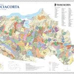
NEW! The Geographical Units based on the Napoleonic Land Registry of 1807; detailed text on the back about the territory, climate and geology.
Product Description
The world’s first map which offers the possibility of discovering, one by one, the production zones (Geographic Units) of this prestigious appellation based on the Napoleonic Land Registry of 1807.
Front:
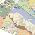
The morphology of the territory with contour lines and altitude levels.
Indications of the main production zones and of the main place names.
Back:
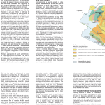
A in-depth description of the territory and of the appellation rules.
Simplified orographic map of the appellation.
Simplified geological map of the appellation.
Size: 59 x 84 cm (unfolded), 21×29,7 (A4 – folded)

Additional Information
| Weight | 0,06 kg |
|---|
Be the first to review “Franciacorta”
Related Products
-

La Morra, Roddi, Cherasco english edition
Categorie: Maps7,00 € Add to cart ViewThe most detailed map of the official crus of La Morra, Roddini, and Cherasco. Discover, rapidly and directly, each and every aspect of the crus
which are part of the history of Barolo (Brunate, Cerequio, Rocche dell’Annunziata…). -

Radda in Chianti
Categorie: Maps7,00 € Add to cart ViewThe “Cru di Enogea” Chianti Classico series – third issue.
Radda in Chianti, when Sangiovese is synonymous with elegance.
-

Bordeaux (AOC Pauillac, Saint-Julien, Saint-Estèphe)
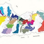
Categorie: Maps15,00 € Add to cart ViewThe world’s first and only map which offers you the possibility of exploring, parcel by parcel, the vineyards of the most important Châteaux of Médoc (AOC Pauillac, Saint-Julien, Saint Estèphe). NEW UPDATED EDITION
Reviews
There are no reviews yet, would you like to submit yours?