
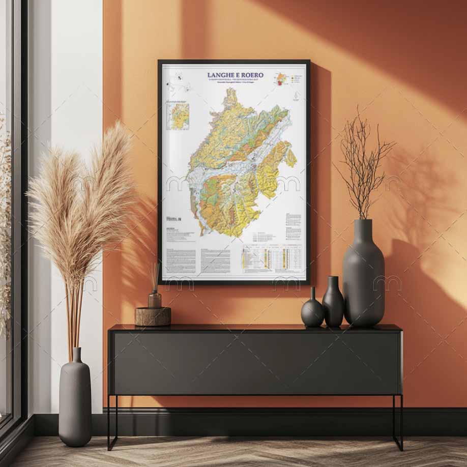
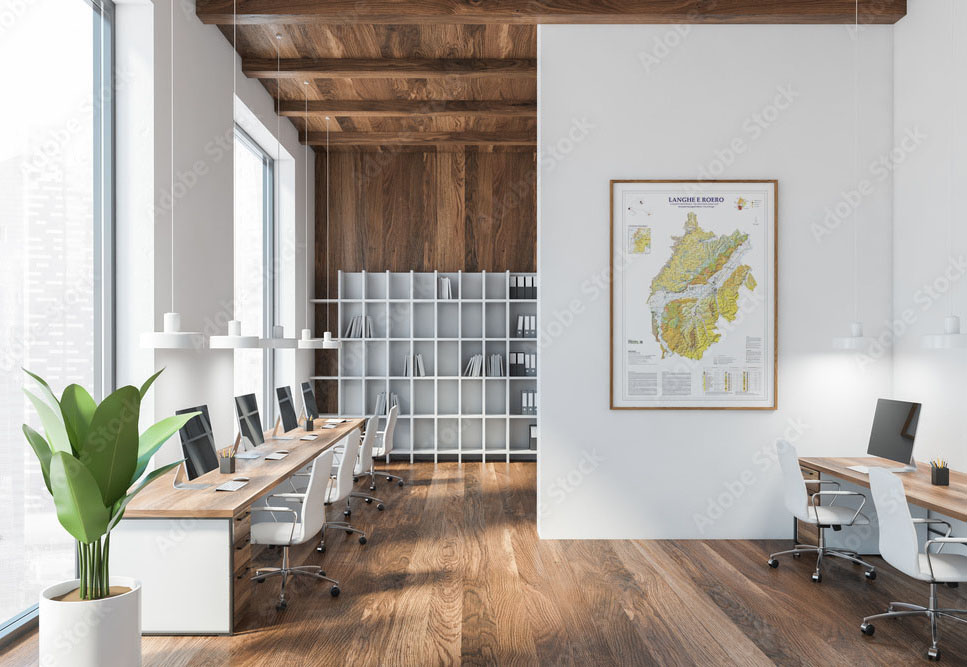
Langhe e Roero Geoviticultural Map Poster Edition
39,00 €
NEW!! Shipping from October 10, 2025. The geology of Langhe and Roero in a single map printed on high-quality Japanese paper. Size: 70×100 cm. LIMITED AVAILABILITY
Product Description
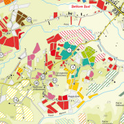
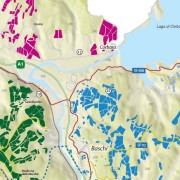
The map that completes the trilogy of geoviticultural maps of the Alba area.
It covers the areas of Barolo (including parts of the municipalities of Monforte d’Alba and Novello not included in the DOCG), Barbaresco, Diano d’Alba, and Roero.
It includes a simplified map of the geology of southern Piedmont, a table with soil characteristics, and geosites.
A unique work, which was never done before and printed in poster format (no text on the back), it’s shipped rolled up in a protective tube.
Perfect for framing and for a gift that will impress even the most demanding enthusiast.
Produced in 70×100 cm format on prestigious and exclusive 320 gsm Takeo Vent Nouveau Japanese paper.
Additional Information
| Weight | 1,52 kg |
|---|---|
| Dimensions | 70 × 100 cm |
Be the first to review “Langhe e Roero Geoviticultural Map Poster Edition”
Related Products
-
Romagna Sangiovese
Categorie: Maps10,00 € Add to cart ViewRomagna as seen through the 12 official Sangiovese sub-zones- from Imola to the Rubicon, from the foothills of Faenza to the most isolated parts of the Apennine chain
-
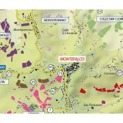
Montefalco Map
Categorie: Maps Paper Magazines10,00 € Add to cart ViewThe first map dedicated to Montefalco, Sagrantino and its production zones. Precise, detailed, indispensable. As always.
-
Vino Nobile di Montepulciano
Categorie: Maps7,00 € Add to cart ViewThe world’s first map which offers the possibility of discovering, one by one, the estates and the most important viticultural zones of this prestigious Tuscan appellation. From Argiano to Asinone and from Cervognano to Caggiole, as always a unique and inimitable map in its precision and detail.
-
Orvieto
Categorie: Maps10,00 € Add to cart ViewNEW EDITION 2023 Orvieto, a white wine known all over the world and a territory which, for beauty, has few equals in Italy.
Sala, Rocca Ripesena, Corbara are just a few of the spots which you can discover thanks to the usual inimitable details of the Enogea maps.
And with something more as well…
Reviews
There are no reviews yet, would you like to submit yours?