
Sauternes e Barsac
7,00 €
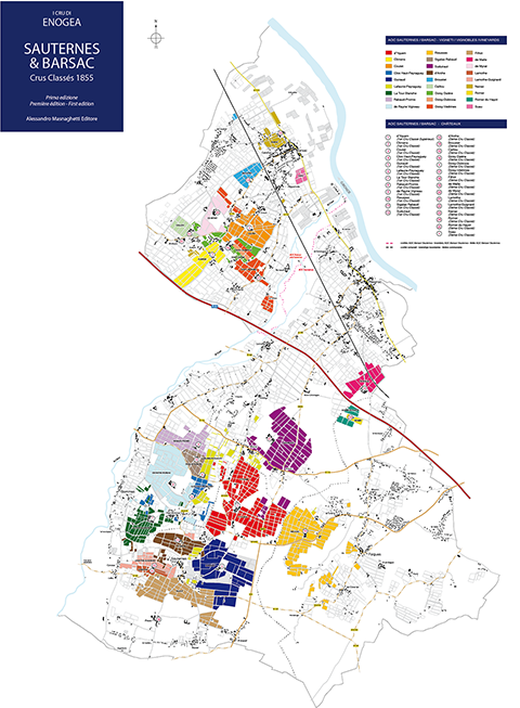
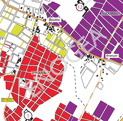
The world’s and first only map which offers you the possibility of exploring, parcel by parcel, the vineyards of the famous Crus Classés 1855 of Sauternes and Barsac (Yquem, Climens, Coutet, Guiraud, Rieussec…)
Out of stock
Product Description
A unique opportunity to raise your knowledge of this great French viticultural region to a superior level.
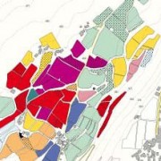
Front:
a detailed, vineyard by vineyard map of the Sauternes and Barsac appellations, showing – in color – the vineyards of the individual Châteaux
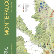
Back:
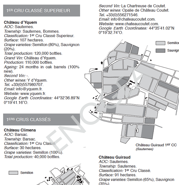
- maps of the Crus Classés 1855, including all of the Premier crus, and, in particular:
- maps of the estates as entire units
- maps of the estates varietal composition
- fact sheets of the individual classified Crus, including:
- reliable google coordinates for the individual classified Crus
- vineyard surface
- wines produced
- varietal percentages in the estate vineyards bottles produced
- information for contacts
Size: 59 x 84 cm (unfolded), 21×29,7 (A4 – folded)
Additional Information
| Weight | 0.06 kg |
|---|
Be the first to review “Sauternes e Barsac”
Related Products
-
Barolo Geoviticultural Map
Categorie: Maps10,00 € Add to cart ViewThe geo-viticultural map of Barolo now available in the classic Enogea format (printed and FOLDED). Innovative, not expensive and easy to handle!
Reviews
There are no reviews yet, would you like to submit yours?